Tunnels Bunkers and Dungeons of the
Cape
1663 Cape Town’s Canals
The early streets ran parallel and at right angles
to the streams that flowed from the mountain to the sea. Later, these streams
were formalized and directed into ‘grachte’
For example the Heerengracht (today Adderley Street), was the first principal
street of the settlement, following the course of the Fresh River to the fort.
It was threaded by a double streamlet, with tiny bridges crossing at intervals.
It ran through the town centre and continued the axis of the Company’s Garden
linked by way of an old gateway, was lined with stoeped townhouses of the
burghers and at its foot was the wooden jetty. By 1767 the street had been
widened into a fashionable promenade. It was described by a traveller in 1778
as “the most beautiful street or canal, bordered with oaks, along which are
built the finest houses.”
The ‘grachte’ had become the dumping place for the town’s rubbish. Thus, a
systematic programme of arching over and enclosing the canals was initiated in
1838, directly changing the character of old Cape Town. At first a number of
bridges were built over the canals and some canals paved.
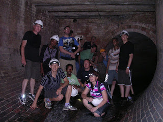
Eventually the majority of the grachte had been replaced by brick sewers. By
the end of the 1850s, the last stretch of the Heerengracht had been covered and
the street, renamed Adderley Street. When the Bubonic Plague broke out in Cape
Town in 1901, the last of the open water courses was closed, in District Six.
Comment: Moderate Historical walking Tour not suitable for all.
Operating on sunny days when no cloud cover and water levels are low. Maximum 8
participants.


No comments:
Post a Comment